

NATIONAL NEWS - According to the South African Weather Service, a series of significant cold fronts are expected to affect the Western and Northern Cape until Sunday, 14 July.
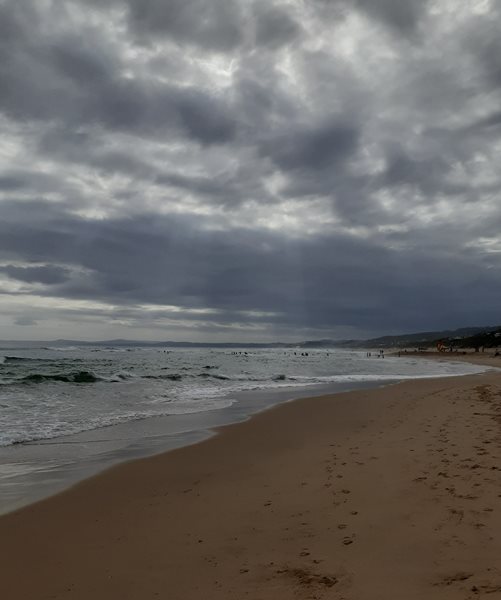
The public and small stock farmers are advised that intermittent heavy rainfall, snowfalls, very cold conditions, strong coastal and interior winds and very rough seas can be expected.
Severe weather alerts: Impact based warnings
Thursday-Saturday
A. Yellow level 4 warning for damaging winds are expected along the coast between Lambert's Bay and Mossel Bay on Thursday and Friday, as well as over the southern parts of the Namakwa (Northern Cape), City of Cape Town, Cape Winelands, Overberg, Central Karoo and western parts of Garden Route (W. Cape) on Thursday and Friday (11-12/07/2024).
B. Yellow level 4 warning for disruptive rain leading to damage of roads and bridges is expected over the West Coast, eastern Cape Winelands and Overberg districts (Western Cape) on Thursday 11 July.
C. Orange level 6 warning for disruptive rain leading to flooding and possible mudslides is expected over the Witzenberg and Swartland municipalities (Western Cape) on Thursday 11 July.
D. Orange level 8 warning for disruptive rain leading to flooding and possible mudslides is expected over the City of Cape Town, Drakenstein and Stellenbosch municipalities (Western Cape) on Thursday.
E. Yellow level 4 warning for damaging waves leading to difficulty in navigation at sea is expected between Alexander Bay and Plettenberg Bay on Thursday and Friday 11-12 July.
F. Yellow level 4 warning for disruptive rain leading to localised flooding of roads and settlements, is expected over City of Cape Town, Swartland, Drakenstein, Stellenbosch and Theewaterskloof municipalities on Friday through to Saturday 12-13 July.
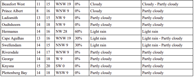
Weather forecast for Friday 12 July:
‘We bring you the latest Garden Route, Hessequa, Karoo news’


