


GARDEN ROUTE | KAROO NEWS - In the latest weather update from the South African Weather Service, there are no weather warnings for the Western Cape.
However, the following weather warning was issued for the Eastern Cape:
A. Yellow level 2 warning for damaging waves resulting in difficulty in navigation with small vessels at risk of taking on water and capsizing within the locality, and localised disruption to ports/harbours between Plettenberg Bay and East London.
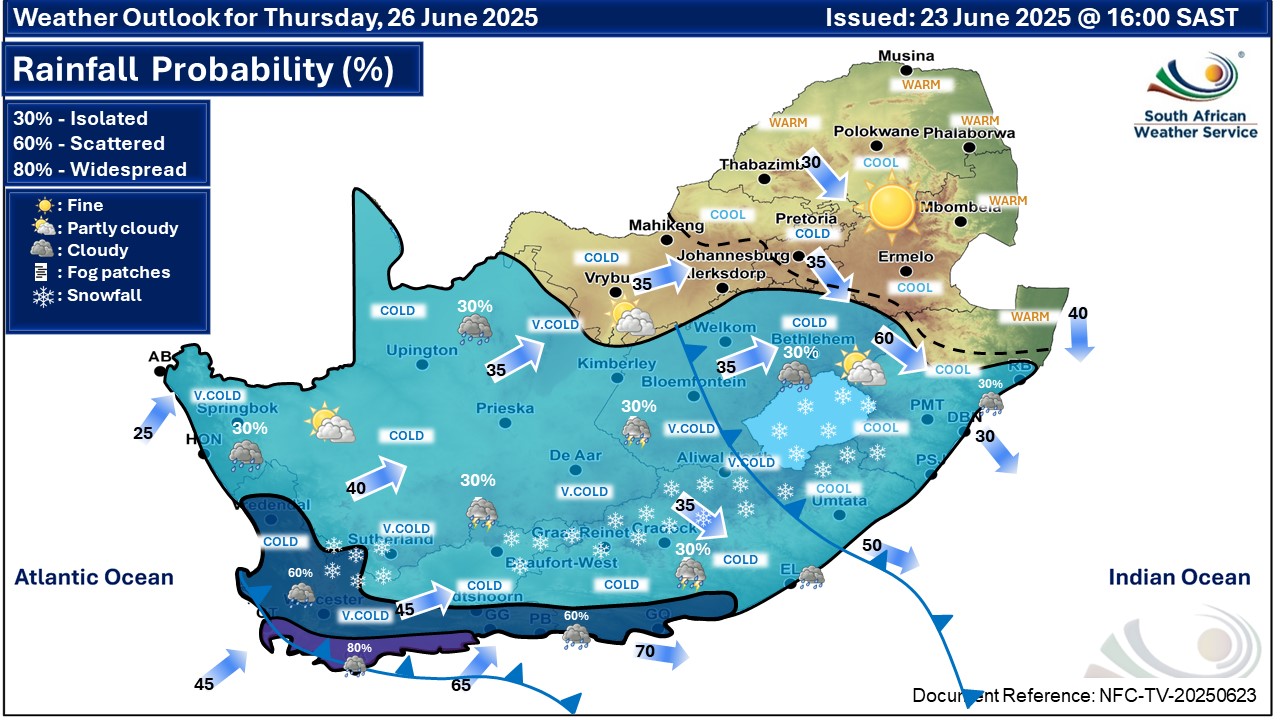
As previously mentioned, an intense cold front is expected to affect the Western, Northern and Eastern Cape provinces from Wednesday until Friday.
The public and small stock farmers are advised that very cold, wet and windy conditions with heavy rainfall, strong interior winds and gale force coastal winds, very rough to high seas and light snowfall on the high ground can be expected.
Weather forecast for Tuesday 24 June:
Western Cape
Morning fog over the northern parts, otherwise partly cloudy and cool to cold. The wind along the coast will be fresh to strong northerly to north-westerly, but light to moderate easterly along the south coast. The expected UVB sunburn index: Low
Western half of the Eastern Cape
Morning fog in places over the interior where windy conditions can be expected in places in the afternoon, otherwise partly cloudy and cold but fine in the north-east. The wind along the coast will be light to moderate north-westerly, becoming light to moderate north-easterly late morning.
Eastern half of the Eastern Cape
Morning fog in places over the interior, otherwise fine and cool but cold in the extreme north. Windy conditions can be expected in places over western interior in the afternoon. The wind along the coast will be light to moderate north-easterly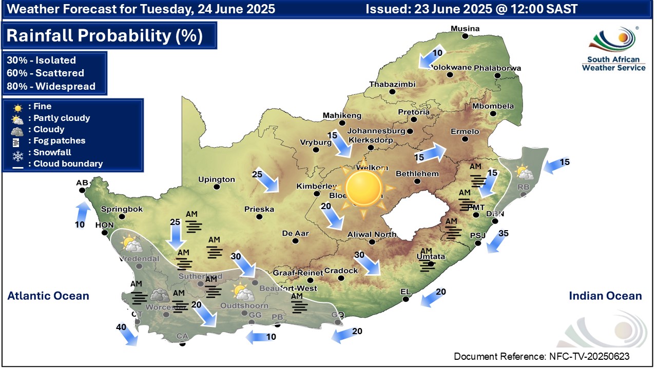


‘We bring you the latest Garden Route, Hessequa, Karoo news’


