


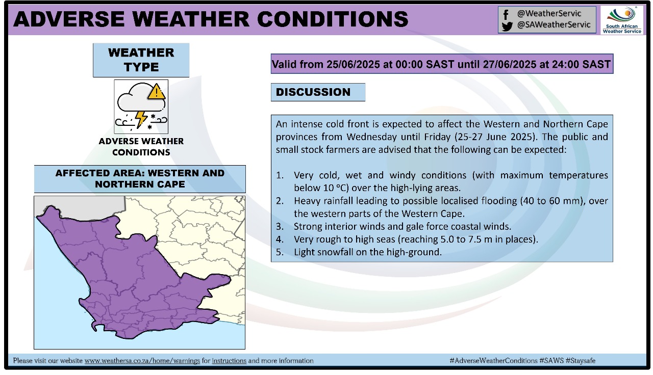
GARDEN ROUTE | KAROO NEWS - According to the SA Weather Service, an intense cold front is expected to affect the Western and Northern Cape provinces from Wednesday until Friday, 25-27 June.
The public and small stock farmers are advised that very cold, wet and windy conditions with heavy rainfall, strong interior winds and gale force coastal winds, very rough to high seas and light snowfall on the high-ground can be expected.
Impact-based warnings
A. Yellow level 4 warning: Damaging waves leading to damage to coastal infrastructure and disruption to beach front activities are expected along the coast between Alexander Bay and Cape Agulhas from Wednesday evening into Thursday.
B. Yellow level 2 warning: Damaging winds leading to difficulty in navigation at sea and localised disruption to small ports and harbors are expected between Cape Columbine and Cape Agulhas on Wednesday.
Weather forecast from Wednesday to Friday:
The public is advised that the following weather conditions can be expected:
- Very cold, wet and windy conditions (with maximum temperatures below 10°C) over the high-lying areas.
- Heavy rainfall (40 to 60mm), predominantly over the western parts of the Western Cape.
- Strong interior winds and gale force coastal winds.
- Very rough to high seas (reaching 5.0 to 8.0 in places).
- Light snowfall on the high ground.
‘We bring you the latest Garden Route, Hessequa, Karoo news’


