


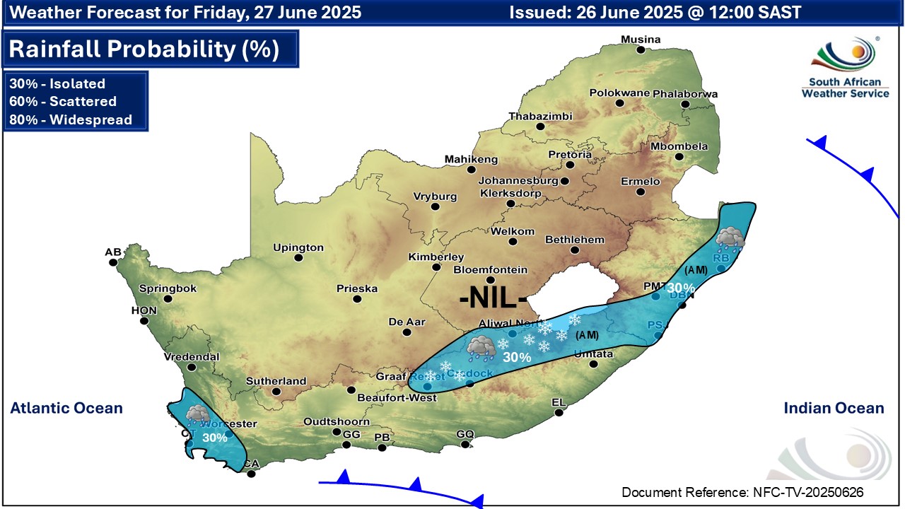
GARDEN ROUTE | KAROO NEWS - The South African Weather Service (Saws) has released its latest weather forecast for Friday, 27 June.
Expect light snow that could lead to traffic disruptions in parts of the Eastern Cape and very cold and windy conditions in the Western and Eastern Cape. Here’s what you need to know.
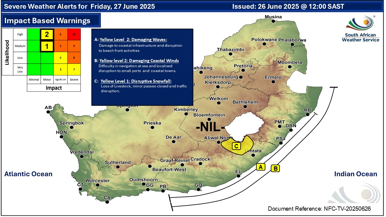
Weather warnings, Friday, 27 June
Impact-based warnings
The weather service has issued yellow level 2 warnings for damaging waves and winds between the Western Cape and KwaZulu-Natal. Expect damage to coastal infrastructure and disruption to beach front activities along the coast between Plettenberg Bay and Cape Vidal, as well as difficulty in navigation between Plettenberg Bay and Kosi Bay.
The waves could also lead to the disruption of small harbours and/or ports for a short period, as well as small vessels taking on water and capsizing a locality.
Saws has also issued a yellow Level 1 warning for disruptive snow resulting in traffic disruption due to icy roads, and isolated loss of vulnerable livestock and crops over the Eastern Cape’s Senqu and Elundini local Municipalities in the morning.
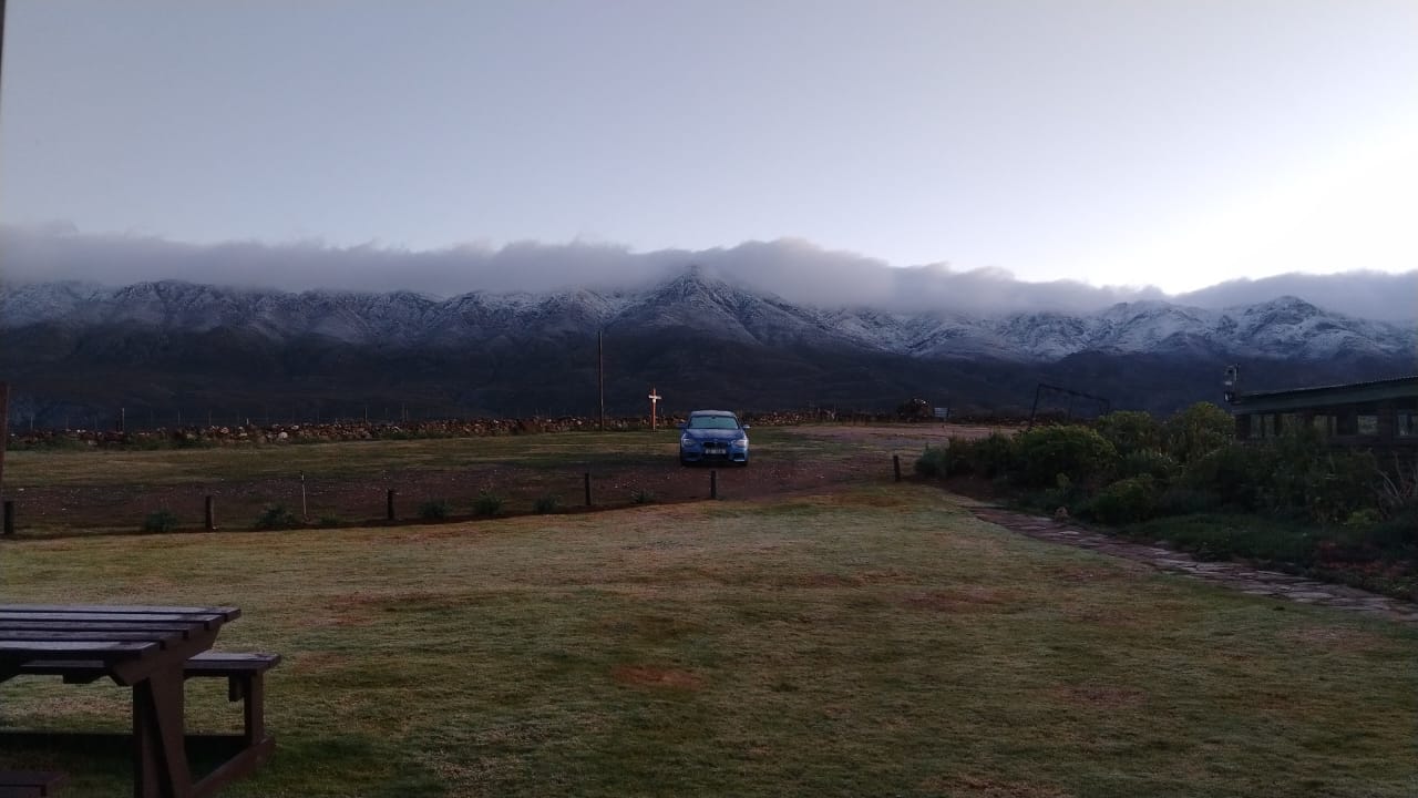 Snow has fallen on the Swartberg mountain range. Photo: Kobus Lategan from Kobus se Gat.
You can see more snow photos here.
Advisories
Expect very cold and windy conditions over the Western Cape, Eastern Cape, southern part of the Northern Cape and in places in the Free State. You can see a video of the snow here.
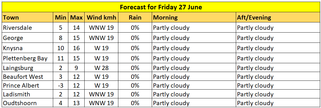
Expected weather in your region:
Western Cape:
Morning fog in places in the west, otherwise cloudy and cold, but very cold in the northern interior and partly
cloudy along the south coast and adjacent. Light rain is expected in the south-western parts. The wind along the coast will be light to moderate westerly to south-westerly, but fresh to strong along the south coast. It will become fresh to strong northwesterly along the south-west coast from the afternoon. The expected UVB sunburn index: Low
Eastern Cape (western half):
Light snowfall in the north at first, otherwise, partly cloudy and cold to very cold, but cool in places along the coast. The wind along the coast will be Fresh to strong westerly, but near gale in places.
Eastern Cape (eastern half):
Light snowfall in the north at first, otherwise fine and cold to very cold, but cool in places along the coast. The wind along the coast will be Fresh to strong southwesterly.
Temperature chart for Friday:
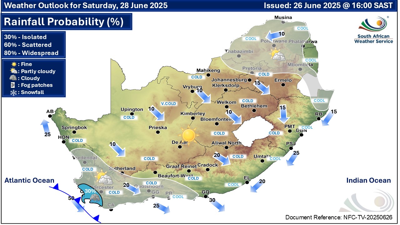
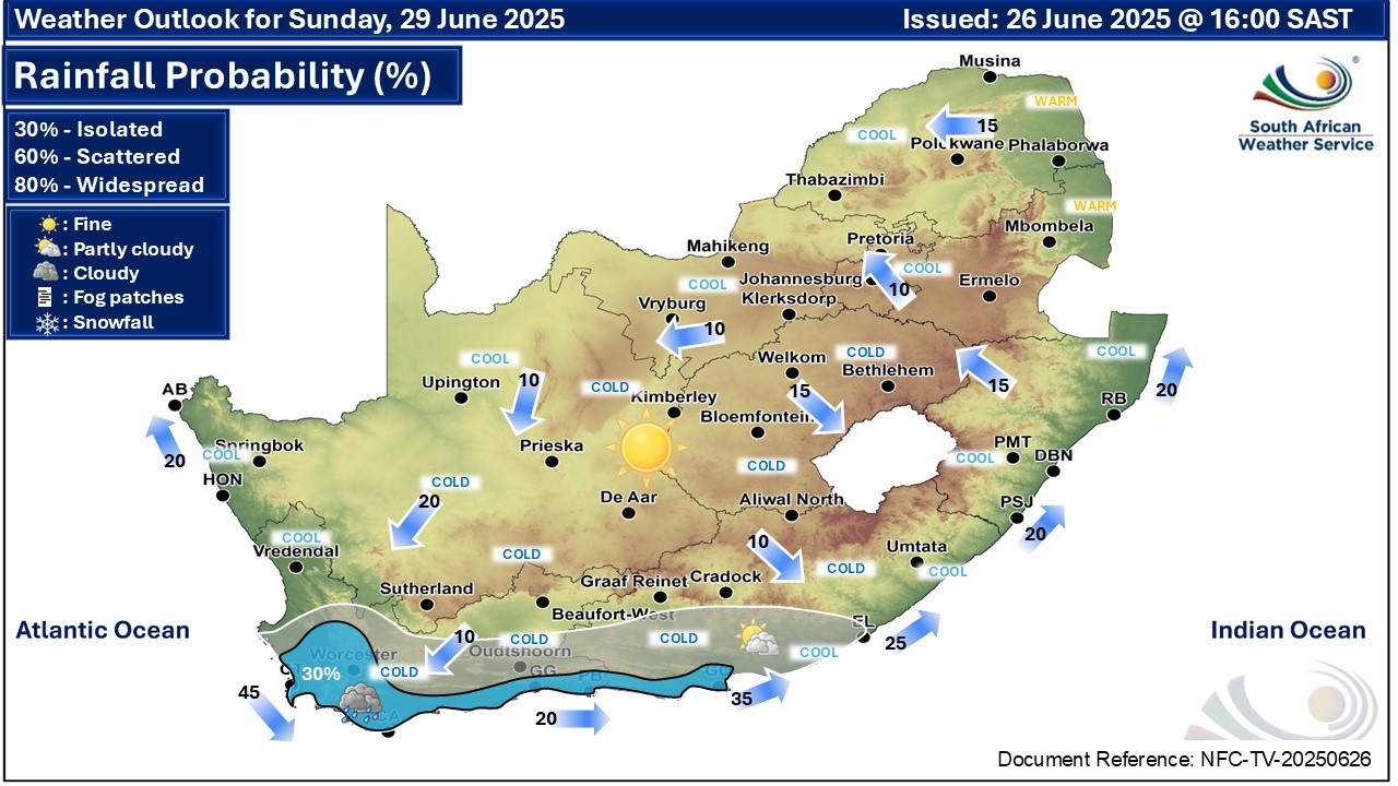
Extended weather forecast for Saturday and Sunday:
Fine and cool to cold but partly cloudy in the north-east and southern parts where isolated showers and rain are expected.
Article: Caxton publication, The Citizen and SAWS
‘We bring you the latest Garden Route, Hessequa, Karoo news’


