

GARDEN ROUTE | KAROO NEWS - Very cold conditions with daytime temperatures of 10° C and below, are expected in places over the interior of the Western Cape and the Namakwa District (Northern Cape) from Wednesday through to Saturday.
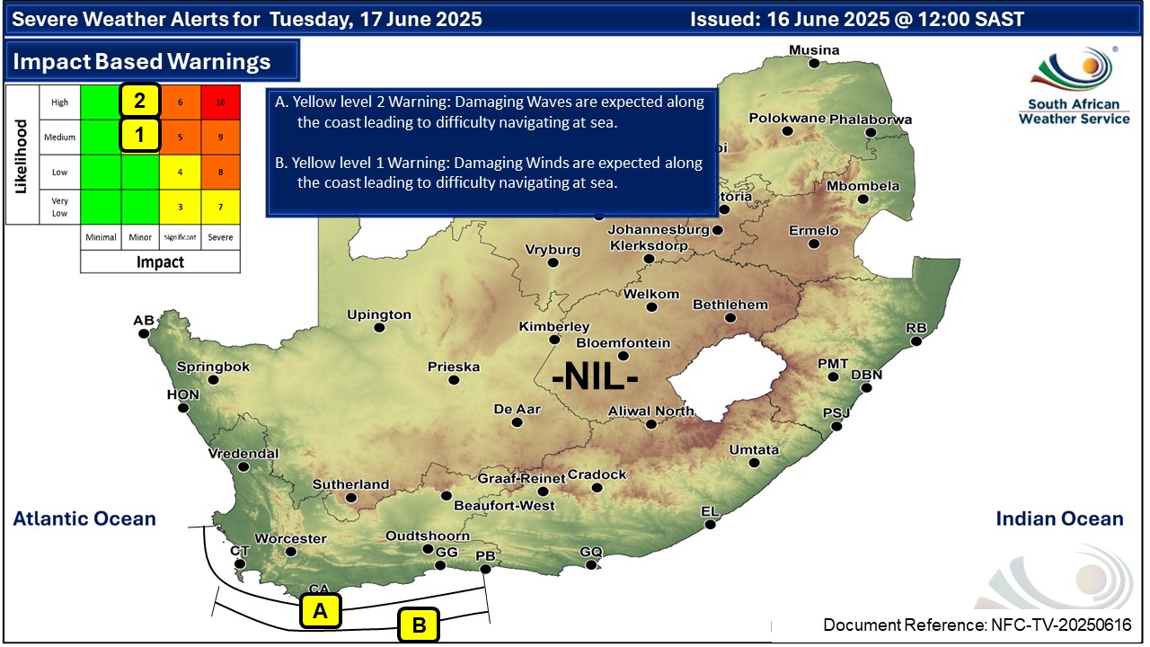
Impact-based warnings
A. A yellow level 1 warning for damaging winds is expected between Cape Point and Plettenberg Bay, resulting in difficulty navigation at sea from Tuesday evening into Wednesday afternoon.
B. A yellow level 2 warning for damaging waves is expected between Saldanha Bay and Plettenberg Bay, resulting in difficulty in navigation at sea from Tuesday until Thursday evening.
Weather forecast for Tuesday 17 June
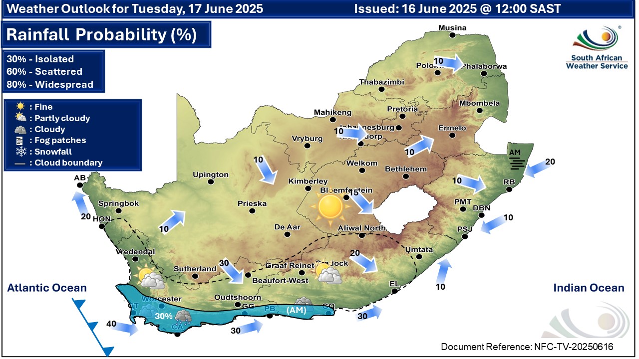
Western Cape
Fine in the north-east, otherwise partly cloudy and cold to cool but cloudy in the south
and south-west where chances of rain can be expected. The wind along the coast will be moderate southerly along the west, but south-westerly along the south in the morning, otherwise north-westerly fresh to strong.
The expected UVB sunburn index: Low
Western half of the Eastern Cape
Fine in the north, otherwise, otherwise partly cloudy and cool but cold in places in the
south with isolated showers of rain along the coast, otherwise fine. It will be cloudy
south of escarpment in the morning.
The wind along the coast will be moderate to fresh westerly to south-westerly.
Eastern half of the Eastern Cape
Fine and cool but cold north of the escarpment otherwise partly cloudy in the far west.
The wind along the coast will be light north-easterly north of East London, otherwise
light to moderate south-westerly.
‘We bring you the latest Garden Route, Hessequa, Karoo news’


