


GARDEN ROUTE | KAROO NEWS - As reported previously, an intense cold front is approaching the Western and Northern Cape according to the South African Weather Service.
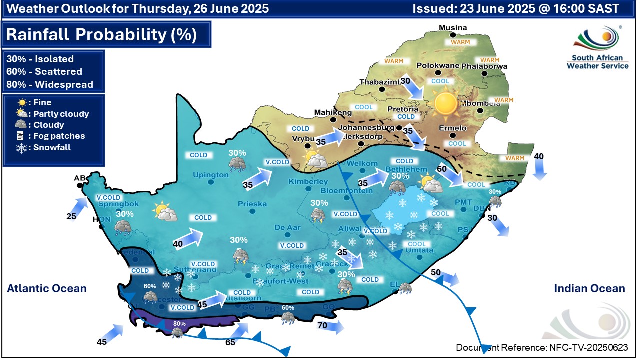
An intense cold front is expected to affect the Western and Northern Cape provinces from Wednesday until Friday.
The public and small stock farmers are advised that very cold, wet and windy conditions with heavy rainfall, strong interior winds and gale force coastal winds, very rough to high seas and light snowfall on the high-ground can be expected.
The following impact-based warnings were issued
A. Yellow Level 4 Warning for damaging waves resulting in damage to coastal infrastructure and disruption to beach front activities is expected along the coast between Alexander Bay and Cape Agulhas, from Wednesday evening spreading to Plettenberg Bay by Thursday.
B. Yellow Level 2 Warning for damaging coastal winds leading to difficulty in navigation at sea and localised disruption to small ports and coastal towns is expected between Lambert's Bay and Cape Agulhas on Wednesday, spreading to Plettenberg Bay by Thursday.
C. Yellow level 2 Warning for damaging interior winds leading to localised problems for high-sided vehicles on prone routes and some transport services affected by wind is expected over the western and northern parts of the Western Cape as well as the southern parts of Namakwa (N. Cape) on Wednesday.
D. Yellow level 2 Warning for disruptive rainfall leading to localised flooding of susceptible formal and informal settlements or roads, and low-lying areas over Cederberg, City of Cape Town, Cape Winelands, and the western parts of the Overberg district (W. Cape) on Wednesday until Thursday morning.
Fire danger warnings
Extremely high fire danger conditions are expected over the Central Karoo district tomorrow, Wednesday 25 June.
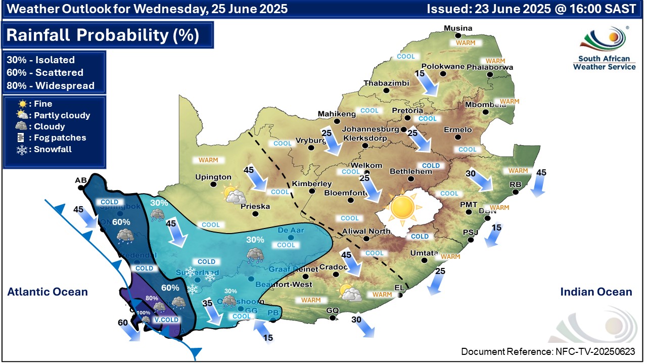
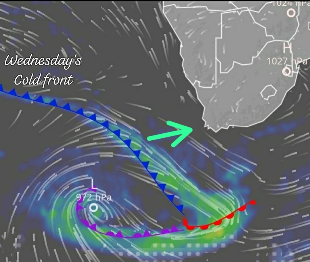 Image: Severe Weather and Information Centre.

‘We bring you the latest Garden Route, Hessequa, Karoo news’


