GARDEN ROUTE | KAROO NEWS - In the latest weather from the South African Weather Service (SAWS), a cold front is approaching from the West, bringing severe weather conditions with it.
Impact-based warnings
A yellow level 4 warning for damaging waves leading to difficulty in navigation at sea for small vessels and personal watercraft is expected between Table Bay and Plettenberg Bay on Saturday until Sunday.
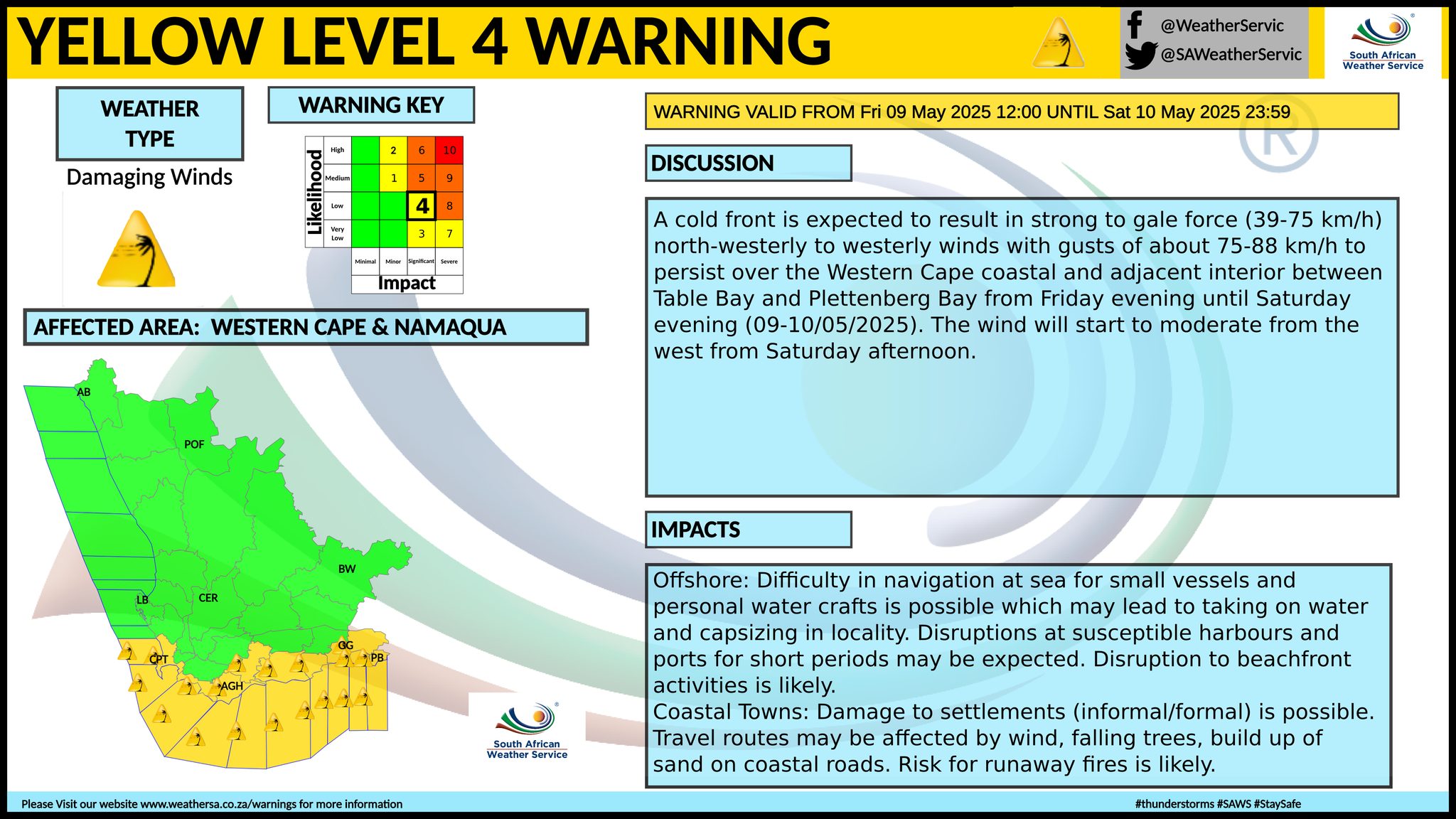
A yellow level 4 warning for damaging winds leading to difficulty in navigation at sea and possible damage to informal settlements is expected between Table Bay and Plettenberg Bay from Friday evening until Saturday evening.
Fire danger warnings
Extremely high fire danger conditions are expected over the interior of the Namakwa in the Northern Cape as well as over the Central Karoo and the Kannaland municipality on Friday 9 May.
Strong wind expected
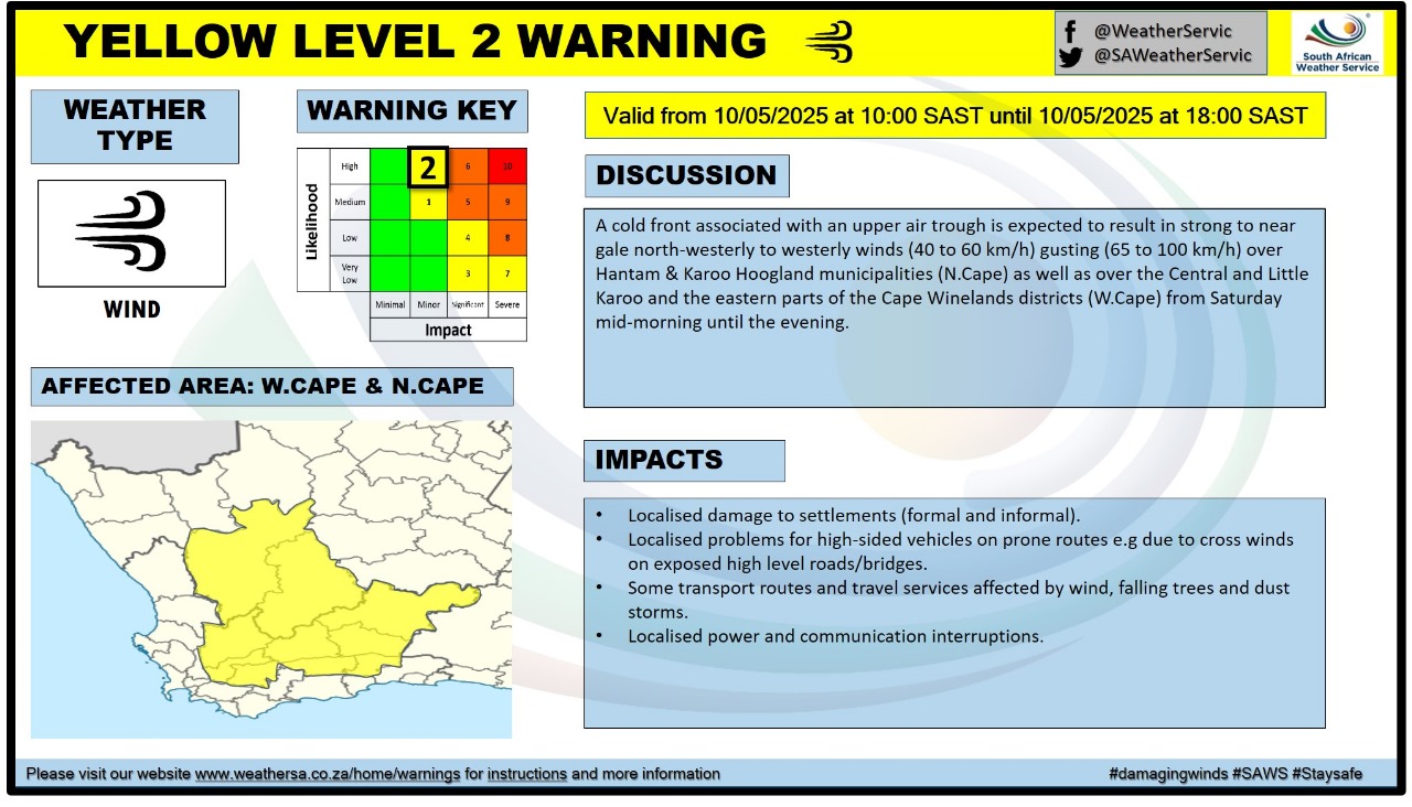
SAWS has also issued a level 2 warning for damaging winds. The warning is valid from Saturday 10 May 00:00 until 23:59.
The affected areas are Beaufort West, Breede Valley, Hantam, Kannaland, Karoo Hoogland, Laingsburg, Langeberg, Oudtshoorn, Prince Albert and Witzenberg.
Expected conditions
A cold front associated with an upper air trough is expected to result in strong to near gale north-westerly to westerly winds (40 to 60 km/h) gusting (65 to 100 km/h) over Hantam & Karoo Hoogland municipalities in the Northern Cape as well as over the Central and Little Karoo and the eastern parts of the Cape Winelands districts in the Western Cape from Saturday mid-morning until the evening.
Advisory
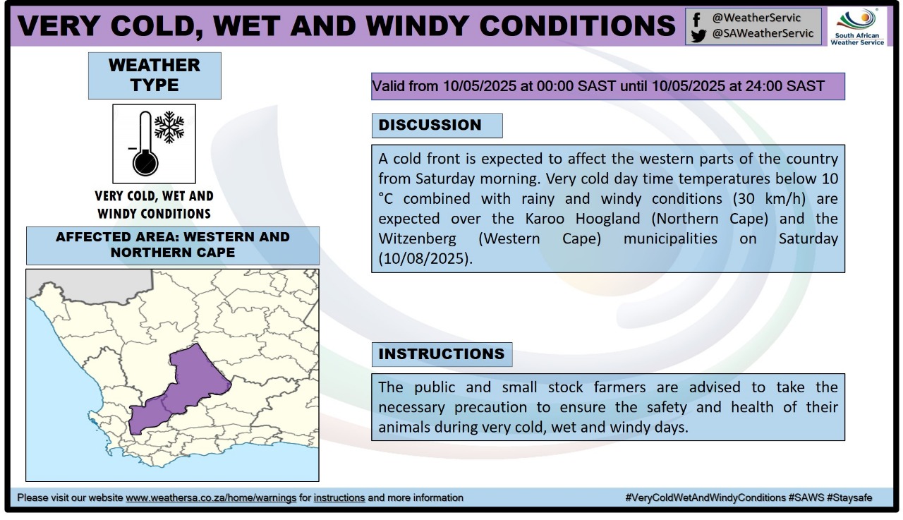
Very cold, wet and windy conditions are expected over the Karoo Hoogland and the Witzenberg municipalities on Saturday.
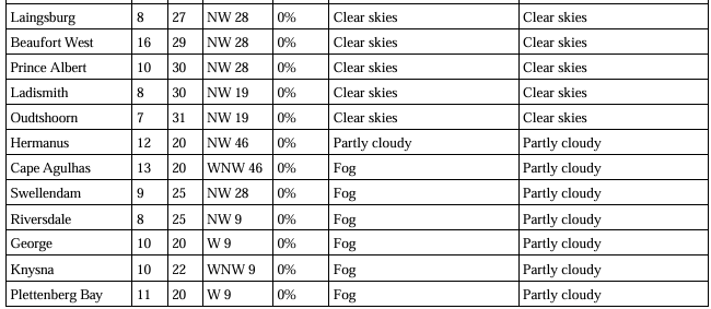
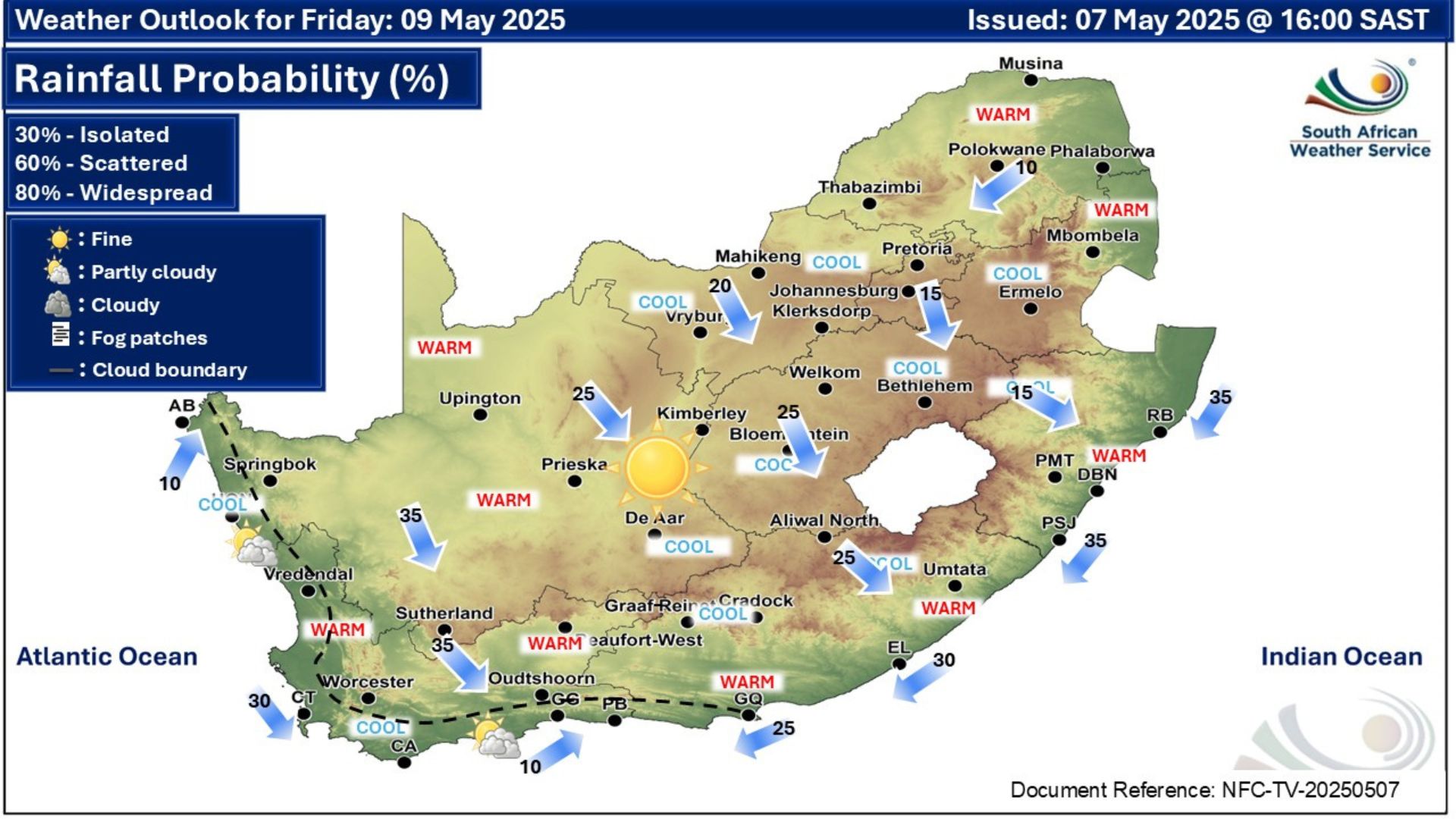
Weather forecast for Friday 9 May:
Weather warning for Saturday:
‘We bring you the latest Garden Route, Hessequa, Karoo news’