GARDEN ROUTE | KAROO NEWS - Vox weather meteorologist Michelle du Plessis said the weather went from extremely hot to extremely wet with severe thunderstorms forecast for today.
“The cut-off layer on Tuesday will also drop freezing levels low enough for snow over the highlands in the Cape provinces, with the most snow expected on Tuesday over the northern highlands in the Eastern Cape,” she said.
Wet weather on the way
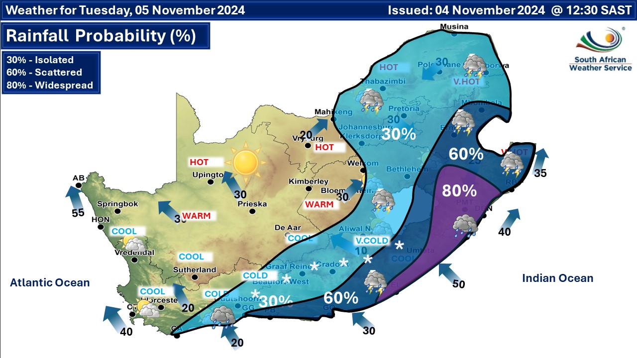
Du Plessis said heavy rain was expected in the Eastern Cape and KwaZulu-Natal (KZN) this week, which could lead to flooding – up to 80mm of rain is possible – over the southern coast of KZN and the northern coast of the Eastern Cape and the adjacent hinterland.
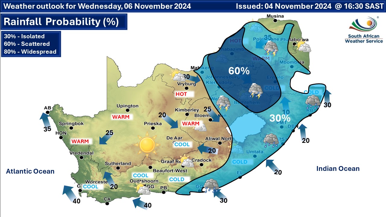
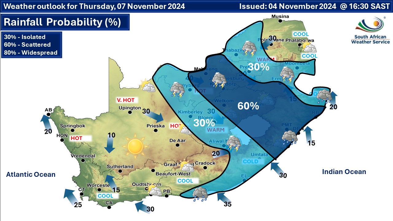
Du Plessis said there was a chance for isolated to scattered rain and thundershowers from today to Friday in Gauteng and the surrounding provinces, especially in the North West, the Free State and across the Highveld.
She said a heatwave is declared when the maximum temperature of a specific town is expected to reach or exceed 5°C above the average maximum temperature of “the hottest month” for that specific location for three days or more.
South African Weather Service spokesperson Hannelee Doubell said they have issued warnings for disruptive snow, rain and damaging winds along the eastern coast region with severe thunderstorms forecast for the interior of the country.
Doubell said a yellow level 2 warning for disruptive snow leading to localised traffic disruptions and localised loss of livestock is expected over the northern and central high-lying areas of the Eastern Cape as well as another yellow level 4 warning for disruptive rain leading to flooding of settlements and roads.
Damage to property was expected along the Wild Coast in the Eastern Cape and over the southeastern parts of KZN.
Your expected temperatures for today are as follows:
| George | 10 | 16 |
| Knysna | 12 | 18 |
| Mossel Bay | 13 | 17 |
| Riversdale | 9 | 18 |
| Oudtshoorn | 8 | 19 |
| Graaff-Reinet | 9 | 13 |

‘We bring you the latest Garden Route, Hessequa, Karoo news’