



GARDEN ROUTE NEWS - Residents across the Garden Route are being urged to take care as severe thunderstorms are forecast across the region today and Wednesday, bringing the risk of excessive lightning, hail and localised damage.
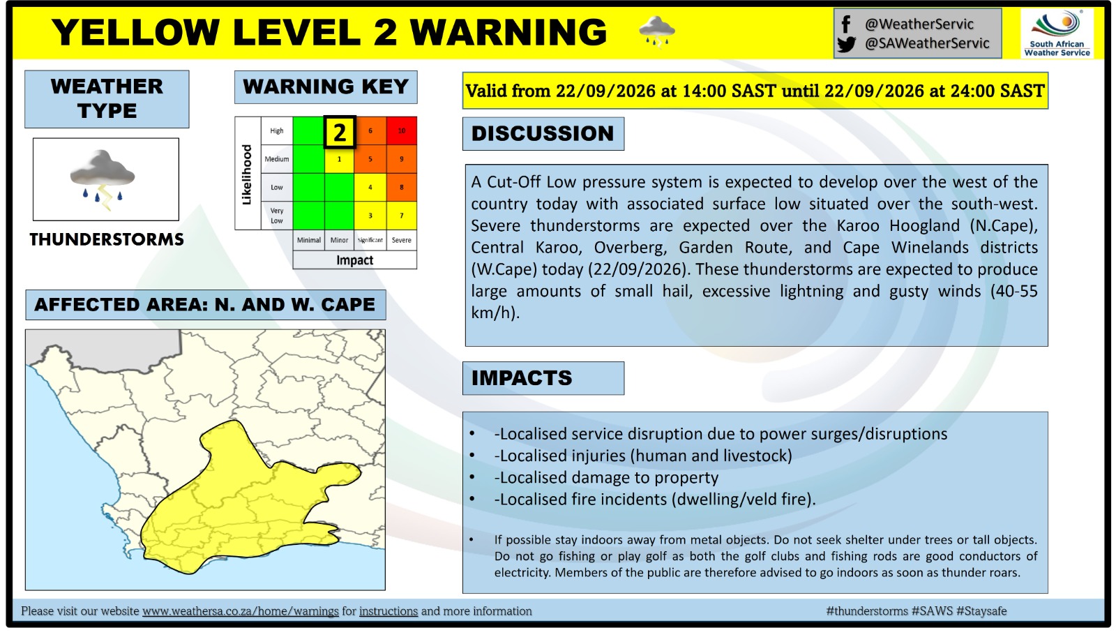
The South African Weather Service has issued a Yellow Level 2 warning for severe thunderstorms covering the Garden Route, Central Karoo, Overberg and Cape Winelands districts of the Western Cape, as well as the Karoo Hoogland in the Northern Cape.
The warning is valid for 22 and 23 September, with the affected area expected to expand to include the City of Cape Town and southern parts of the West Coast on Wednesday.
Severe thunderstorms bring multiple risks
According to the warning, the thunderstorms could result in localised damage to vehicles and infrastructure, excessive lightning and large amounts of small hail.
Residents are as such advised to remain alert as conditions develop, particularly during periods of intense thunderstorm activity.
Thunderstorms can produce hazardous conditions within a relatively short period, with lightning posing a particular risk to people outdoors and hail potentially damaging vehicles, crops, gardens and other exposed property.
Higher-level warning for the Central Karoo
The weather system is expected to be particularly severe over parts of the interior.
An Orange Level 5 warning has been issued for Wednesday for the Hantam and Karoo Hoogland districts of the Northern Cape, as well as the Central Karoo in the Western Cape.
The Orange Level 5 warning indicates the potential for severe thunderstorms that could result in injuries and danger to life, large amounts of small hail and damage or loss affecting infrastructure, settlements and vehicles.
The higher-level warning does not apply to the entire Garden Route, but its presence highlights the strength of the broader thunderstorm system moving across the region.
A sharp change from Tuesday's warmth
The warnings come as the Garden Route experiences a marked change in weather.
George started the week with warm spring conditions, with temperatures expected to reach around 30°C on Tuesday.
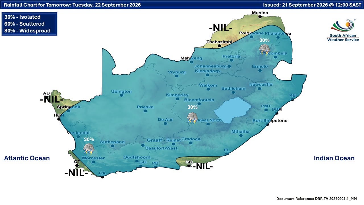
Forecasts then point to a significant drop in temperatures from Wednesday, accompanied by increased cloud and the possibility of showers and thunderstorms.
The unsettled conditions are expected to continue into the latter part of the week, with further thunderstorms and rain possible on Friday and Saturday.
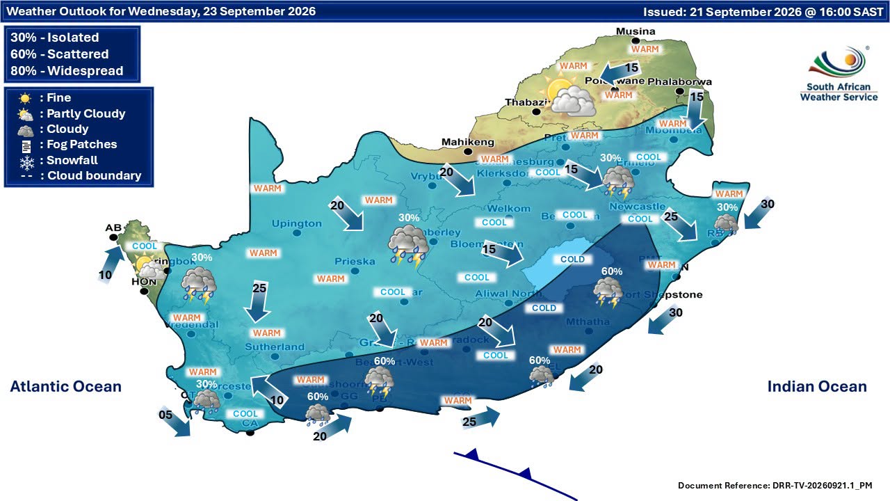
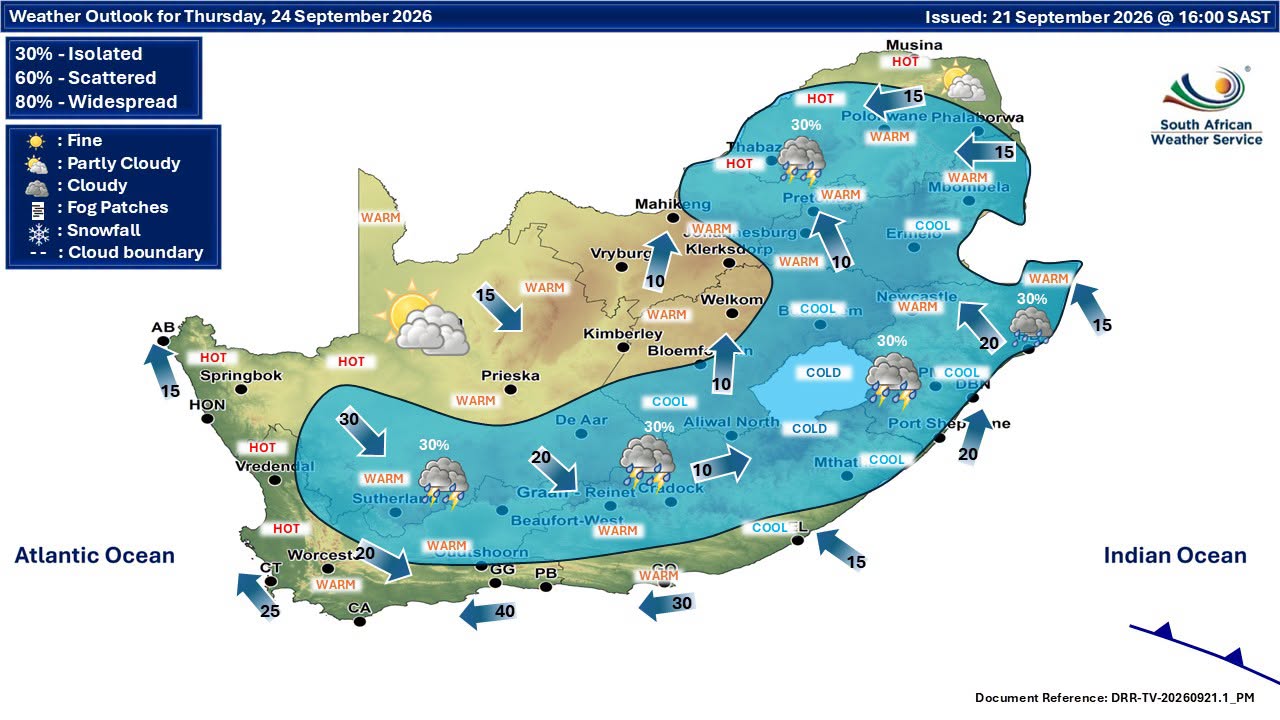
The weekend is currently expected to be considerably cooler than the start of the week, reinforcing the rapid shift from warm spring weather to a much more unsettled pattern.
What residents should do
Residents should monitor updates from the South African Weather Service and local disaster management authorities as the system develops.
During thunderstorms, people are advised to seek shelter indoors where possible and avoid unnecessary exposure to lightning.
Motorists should exercise caution when travelling during heavy thunderstorms, particularly where visibility is reduced or hail accumulates on roads.
Vehicles should, where possible, be parked under cover during periods of hail.
Residents can also reduce potential damage by securing loose outdoor items before storms arrive and keeping away from exposed areas during periods of intense lightning activity.
The Garden Route District Municipality maintains a dedicated severe weather alerts section for updates relating to significant weather systems affecting the district.
Keep watching the forecast
While the current Garden Route warning is Yellow Level 2, weather conditions can evolve quickly. Residents are encouraged to check the latest SAWS warnings before travelling or undertaking outdoor activities, particularly on Wednesday when the broader thunderstorm system is expected to be most active.
For now, the message for the Garden Route is clear: the warm spring weather is giving way to potentially severe thunderstorms, and residents should be prepared for a rapidly changing day.
‘We bring you the latest Garden Route, Hessequa, Karoo news’