

'Concerned resident' of George writes:
I would like to urgently raise concerns about the proposed developments on Erf 195/21, Erf 195/3 and Erf 195/62. George is facing a serious water crisis, yet a high-density development of about 300 residential units, plus double-storey medical facilities, has been approved on Erf 195/3, with infrastructure work reportedly starting soon.
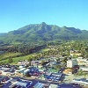
While development is necessary, the location and scale are troubling. These properties lie directly in the line of sight of the Garden Route Dam, one of George's most valued natural and recreational spaces. Many residents treasure the dam for its peace, open green surroundings and sense of escape so close to town.
Hundreds of homes and multi-storey buildings will fundamentally change the visual and environmental character of the area, diminishing the tranquillity that makes the dam special. In my view, these properties should never have been rezoned for estate housing at this scale.
Surely there is a more responsible approach, with lower density, larger green spaces, height restrictions and designs that blend with the landscape? It feels as if we are losing the very essence of the Garden Route. Is this the George we want to leave to future generations?
There are many other areas suitable for development. Building so close to one of the town's only major water sources and cherished natural assets feels unnecessary and short-sighted. I respectfully ask that this development be paused, reviewed and reconsidered in a more environmentally responsible manner.
(Erf 195/3, 195/21, and 195/62 are located near the eastern urban edge bordering the Saasveld Road and the Swart River. The properties are adjacent to the Groenkloof Retirement Resort and Kraaibosch Country Estate, east of Glenwood Avenue and south of the Nelson Mandela University's Saasveld Campus.)
Delia Power, acting director of planning and development, George Municipality, responds:
Environmental protection, water security and preservation of scenic and recreational value remain key municipal priorities. The land falls within the approved urban edge identified in the Municipal Spatial Development Framework in 2013. Much of the development potential stems from land use rights granted years ago, which remain legally valid if all statutory conditions are met.
Where required, developments undergo environmental authorisation processes, including environmental and visual impact assessments with mitigation measures overseen by the relevant authorities. The municipality confirms these developments are not within the Garden Route Dam catchment area and pose no threat to the water resource.
Viewsheds, especially towards the Outeniqua Mountains, remain a priority. Height, design, layout and landscaping are assessed to reduce visual impact and integrate developments with the landscape. Biodiversity rehabilitation and landscaping are enforced as conditions of approval.
No development may proceed without adequate water supply and infrastructure capacity. Efficient water use and sustainable design are mandatory. Climate resilience, compact growth, housing needs, employment creation and environmental stewardship must all be balanced.
The municipality recognises the public's connection to the Garden Route Dam and remains committed to transparent decision-making and ongoing public engagement.