
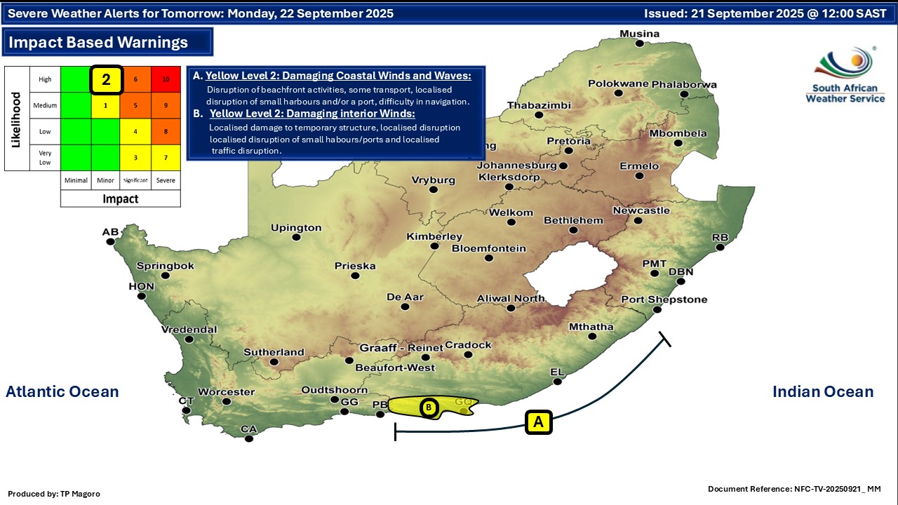
GARDEN ROUTE | KAROO NEWS - In the latest weather update from the South African Weather Service, two warnings have been issued for Monday 22 September.
A. Yellow Level 2: Strong winds and waves are expected along the coast between Plettenberg Bay and Port St Johns. This could make it hard for small boats to navigate, and there is a risk that some may take on water or even capsize in certain areas.
B. Yellow Level 2: Strong winds are expected in some areas along the coast between Plettenberg Bay and Gqeberha. These winds could cause damage to temporary structures, affect small harbours or ports, and cause some traffic disruptions.
Regional weather forecast:
Western Cape
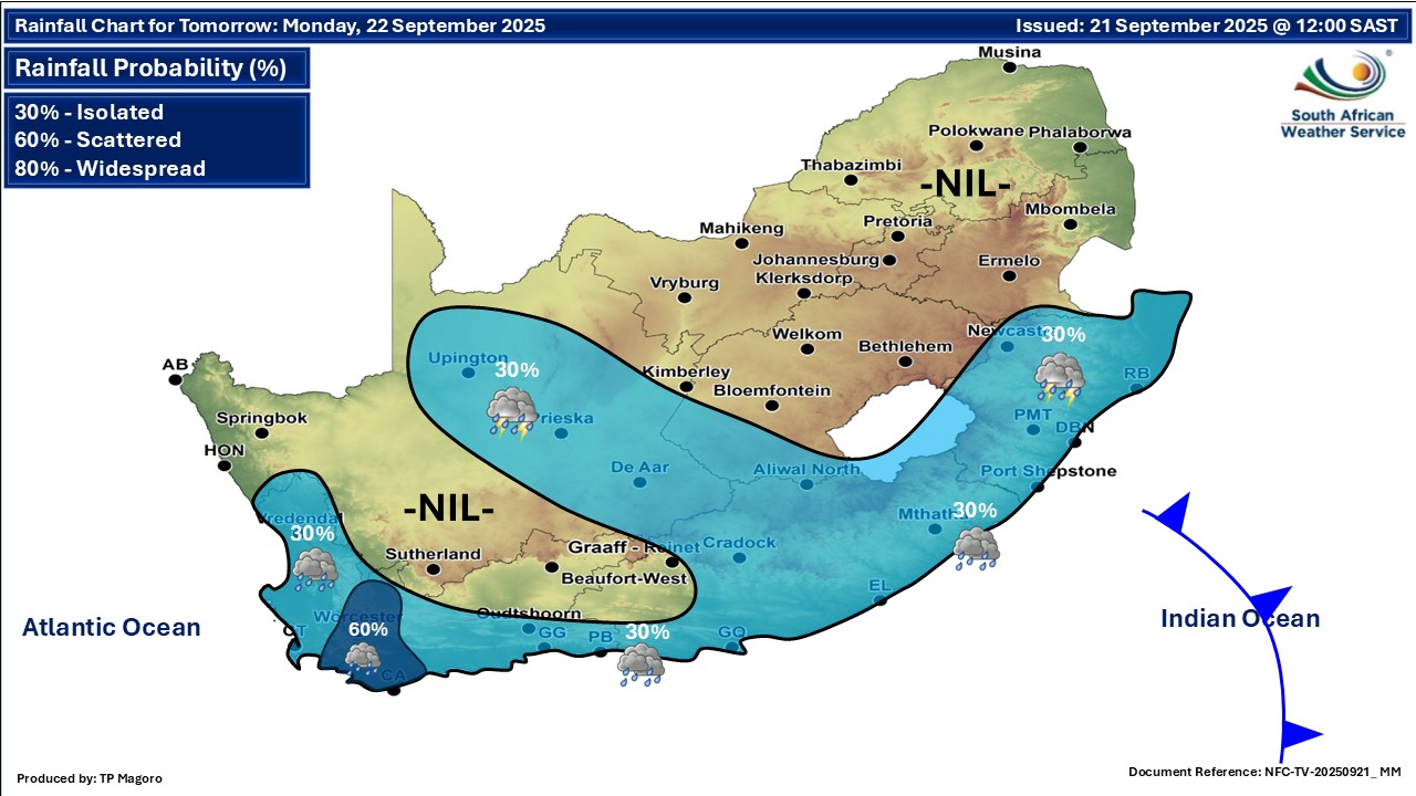
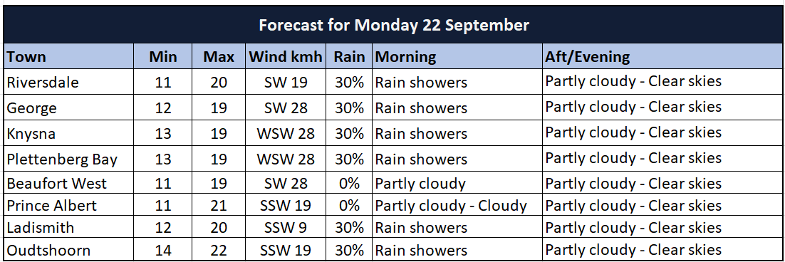
Partly cloudy and cool with isolated to scattered showers and rain over the western and southern parts in the morning. It will become fine from the evening. The wind along the coast will be moderate to fresh south-westerly to westerly but strong along the south coast in the early morning. It will become moderate south-easterly along the west coast from the evening.
The expected UVB sunburn index: Very High
Western half of the Eastern Cape
Partly cloudy, windy and cool with isolated showers and thundershowers in the south and east. It will become fine from late afternoon. The wind along the coast will be moderate to fresh north-easterly east of Algoa Bay early morning, otherwise fresh to strong south-westerly, reaching gale force until the evening.
Eastern half of the Eastern Cape
Partly cloudy, windy and cool with isolated showers and thundershowers, but warm in places south of the escarpment. The wind along the coast will be moderate to fresh north-easterly in places in the morning, otherwise fresh to strong south-westerly, reaching gale force in places in the south from the afternoon.
Expected temperatures:
Extended weather forecast
‘We bring you the latest Garden Route, Hessequa, Karoo news’