


GARDEN ROUTE | KAROO NEWS - In the latest weather update from the South African Weather Service, a cold front is expected to make landfall on Wednesday, 25 June.
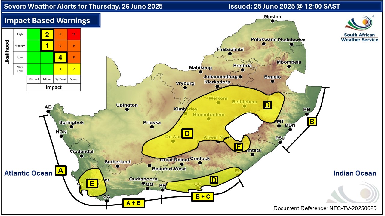
Ahead of the frontal system, strong to gale force winds are expected over the interior of the Eastern Cape on Wednesday and Thursday, 26 June.
As the cold front passes through the Eastern Cape on Thursday, the surface high pressure system will extend its ridge behind it, resulting in cold to very cold conditions in places across the province from, Thursday to Friday 27 June.
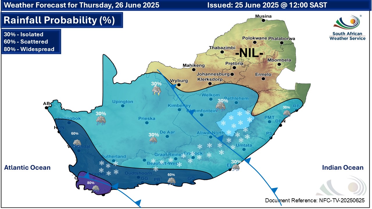
Snowfalls of between 1 to 5 cm accumulation can be expected over the northern high-lying areas on Thursday.
Very rough seas, with wave heights reaching 6m, and strong to gale force winds can also be expected in places along the Eastern Cape coast on Thursday into Friday.
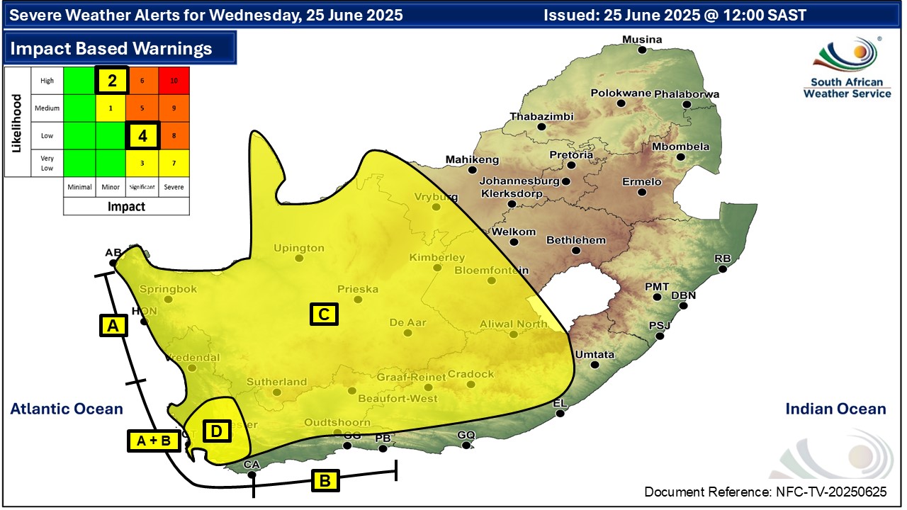
Impact-based warnings:
- Yellow level 2 warning (high likelihood of minor impacts) for damaging winds resulting in localised damage to settlements (formal and informal) and localised runaway fires in places over Chris Hani DM, Joe Gqabi DM, Sarah Baartman DM, Raymond Mhlaba LM and Amahlathi LM on Wednesday, 25 June, and over the coastal areas between Plettenberg Bay and East London Thursday, 26 June.
- Yellow level 2 warning for damaging wind and waves resulting in difficulty in navigation of small vessels with a risk of taking in water and capsizing in the locality between Plettenberg Bay and East London.
- A Yellow level 1 warning for disruptive snow resulting in traffic disruptions due to icy roads, and isolated cases of loss of vulnerable livestock and crops over Senqu and Elundini LMs.
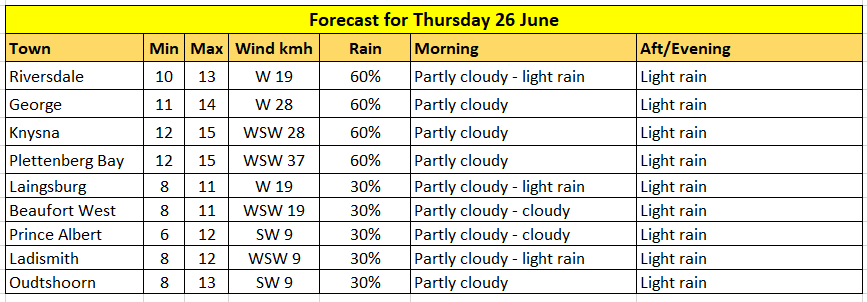
Expected temperatures on Thursday:
‘We bring you the latest Garden Route, Hessequa, Karoo news’


