
GARDEN ROUTE | KAROO NEWS - In the latest weather forecast from the South African Weather Service, a cut-off low (COL) system is expected to make landfall over the western interior of South Africa on Wednesday, 23 April.
It is expected to move slowly eastwards and is likely to exit the country by Saturday, 26 April.
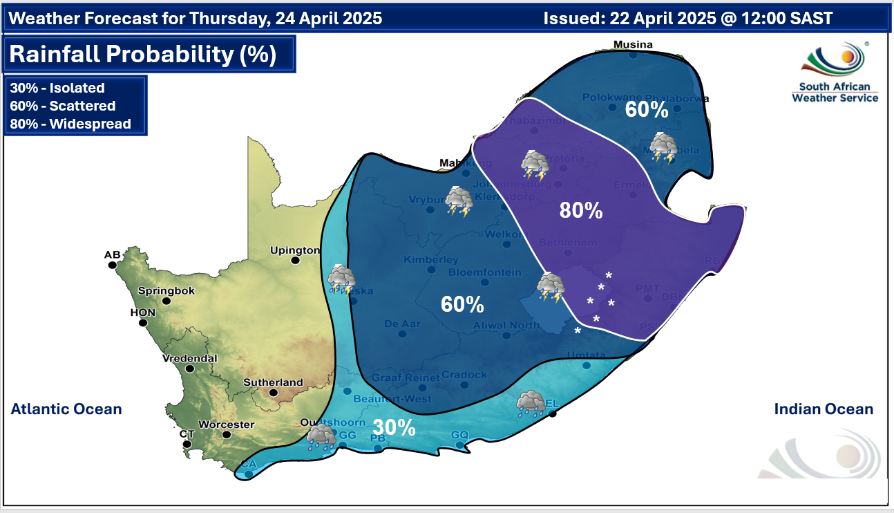
Scattered to widespread showers and thundershowers are expected over the central and eastern parts of the country, with rainfall accumulations exceeding 50 mm in the eastern regions on Wednesday and Thursday, 23 and 24 April (Figure 1 and Figure 2 respectively).
Figure 1: Rainfall probability for Wednesday, 23 April. Source: SAWS.
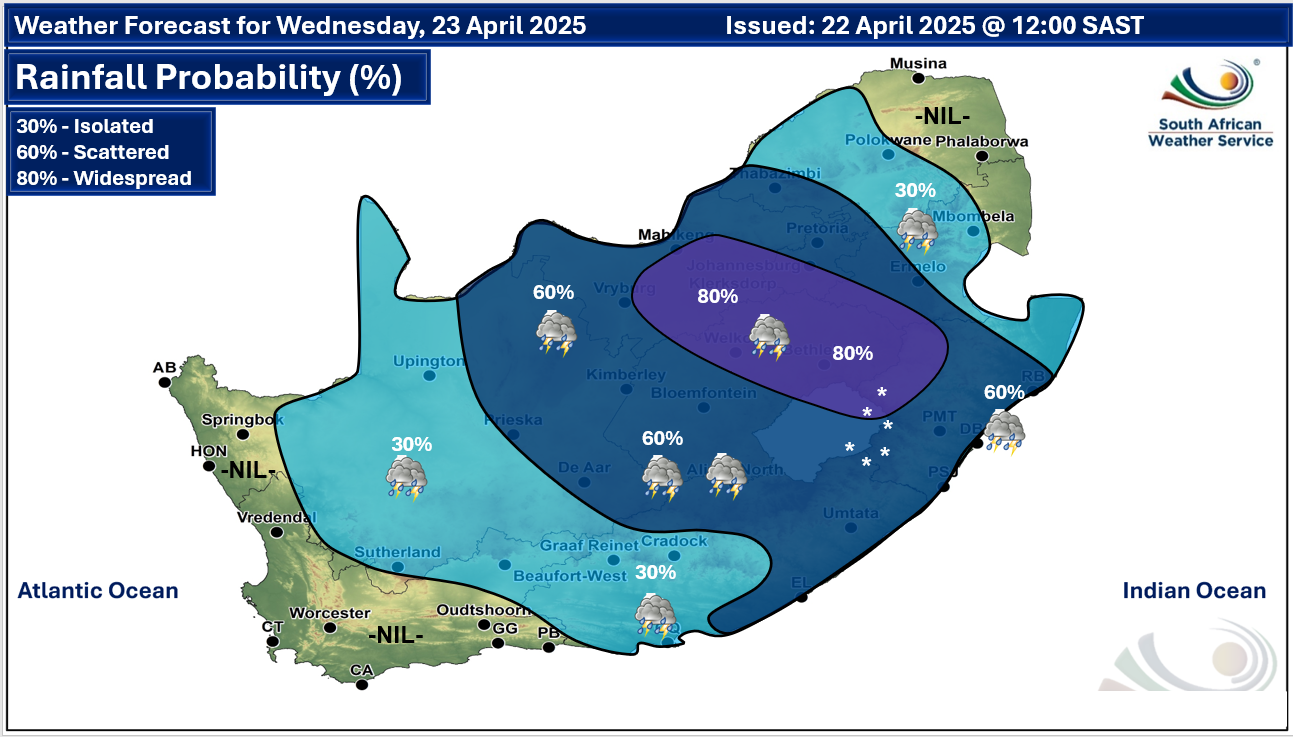
Figure 2: Rainfall probability for Thursday, 24 April 2025. Source: SAWS.
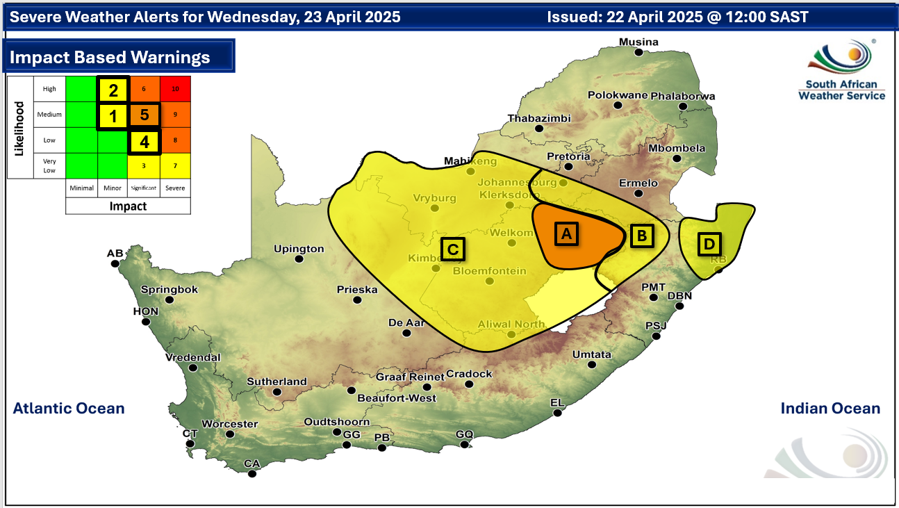
Severe thunderstorms associated with flooding of roads and settlements, as well as damage or loss of infrastructure, property, vehicles, livelihoods, and livestock (Figure 3), especially over the Free State and North West.
There is also a distinct possibility of damaging hail occurring in association with the thunderstorms.
Figure 3: Severe weather alerts for Wednesday, 23 April. Source: SAWS.
Snowfalls are also likely over the Drakensberg mountains in Lesotho, KwaZulu-Natal, and the Eastern Cape during this period.
Moreover, daytime temperatures are also expected to drop significantly from Wednesday onwards, across most parts of the country, with a gradual recovery from Friday onwards.
The South African Weather Service will continue to monitor any further developments relating to the weather systems and will issue subsequent updates as required.
Expected minimum and maximum temperatures for Wednesday, 23 April:
‘We bring you the latest Garden Route, Hessequa, Karoo news’