

GARDEN ROUTE NEWS - Many people believe that much of the forested area from the Cape Peninsula to Port Elizabeth has been cleared since the 1652 arrival of European settlers, and that destruction by humans is the reason for the fragmented nature of the forests today.
However, the distribution of the Southern Cape indigenous forests has not changed much since the arrival of humans, says independent researcher Ryno Joubert, who explains that although many people today believe the whole area from Mossel Bay to Tsitsikamma was covered in forest, this was in fact not the case.
Small patches of forest and forest margins (edges) were destroyed over the years, Joubert says, but this is minimal compared to the size of the whole area’s forests.
Joubert has written an extensive piece explaining this viewpoint (see link at bottom), but has kindly provided Knysna-Plett Herald with the following summary:
According to studies, forests are found in areas that receive annual rainfall ranging between 525mm and 1 220mm.
If you look at the Southern Cape forests, it can be noted that there is no relationship between rainfall and the distribution of forests in the area.
This suggests, to some people, that humans have changed the area through overexploitation.
Many people also believe that if an area’s climate is ideal for forest growth (more than 500mm annual rainfall), the whole region including coastal plateau and sea-facing mountain slopes, will be covered in forest, and that those places where human activities are currently taking place in the form of agriculture, plantations etc, were covered with forests originally.
Source of misperceptions
The occurrence and development of forests are determined by several habitat factors such as climate (of which rainfall is the main determinant), geology, fire and the subsoil moisture regime. Yet many commentators and historians past and present still consider rainfall to be the determining factor, without taking other factors that restrict the development of forests, into consideration.
The first complete vegetation classification for South Africa, attempted by JPH Acocks in 1953 (Veld Types of South Africa), has probably contributed to the perception that the southern and eastern coastal belts were covered in forest around 1400.
His book included a map with the title "Vegetation in AD 1400?" Sadly, only a few people notice the question mark at the end of the map title and realise that both the book and map are based on assumptions. This assumption was, in all likelihood, based on the rainfall potential. (Stehle, 2007)
Historial distribution
Palaeontological evidence as to the distribution of the Southern Cape forests suggests that forests, woodland, grassland and fynbos have occurred in mosaics over the past 10 000 to 20 000 years. Forests expanded during wetter periods and shrank during drier periods.
Nevertheless, fynbos, grassland, woodland and savanna have become more prominent over the last couple of thousand years due to an increasingly drier climate as they are better adapted to arid conditions and fire, which has played a major role in determining the pattern of forests.
Written accounts by European travellers over the past 400 years describe a situation not very different from that found today. This does not mean that there hasn’t been forest destruction by humans.
It is just that the scale at which this took place is much smaller than is generally believed.

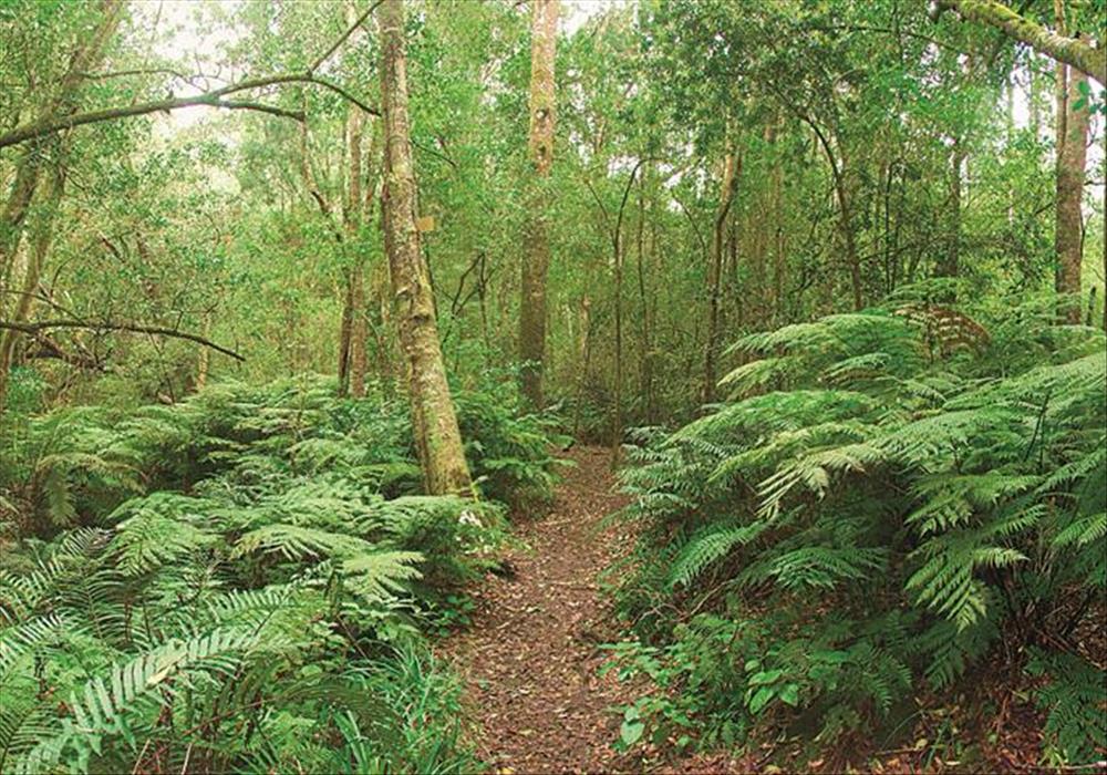
Written accounts by European travellers over the past 400 years describe a situation not very different from that found today. This does not mean that there hasn’t been forest destruction by humans. It is just that the scale at which this took place is much smaller than is generally believed, says researcher Ryno Joubert. Photo: Supplied
Limiting factors
There are two factors that limit forest occurrence and distribution:
• Environmental factors: The potential of an area to sustain forest growth is determined by rainfall, temperature and geology, but the actual occurrence and distribution patterns of forest in the area are determined by fire, ignited by lightning, and then driven through the landscape during subsequent hot, dry berg wind conditions.
• Human factors: Before the arrival of settlers, groups of San hunters occasionally smoked animals out of the forests during hunts, and this could have been the cause of some forest fires in the past. The Khoi people were pastoralists and frequently burned the veld to obtain grazing for their cattle. Since the arrival of settlers, the limiting factors have been grazing, exploitation, clearing, human-made fire and plantations.
Proof for true situation
For the true situation regarding the distribution of the forests, one needs to consider historical and scientific proof in the form of descriptions by early explorers who travelled through the Cape during the late 1700s, historical maps, sketches and paintings; and findings of studies done in the Southern Cape over recent years by various scientists, which provide evidence about the occurrence and distribution of indigenous forests past and present.
For more information, email [email protected].
'We bring you the latest Garden Route news'


