

GARDEN ROUTE | KAROO NEWS - Dangerous sea conditions, strong winds and large swells are expected from Cape Columbine to Cape Agulhas before spreading towards Plettenberg Bay, with risks for small vessels, beachgoers and coastal activities.
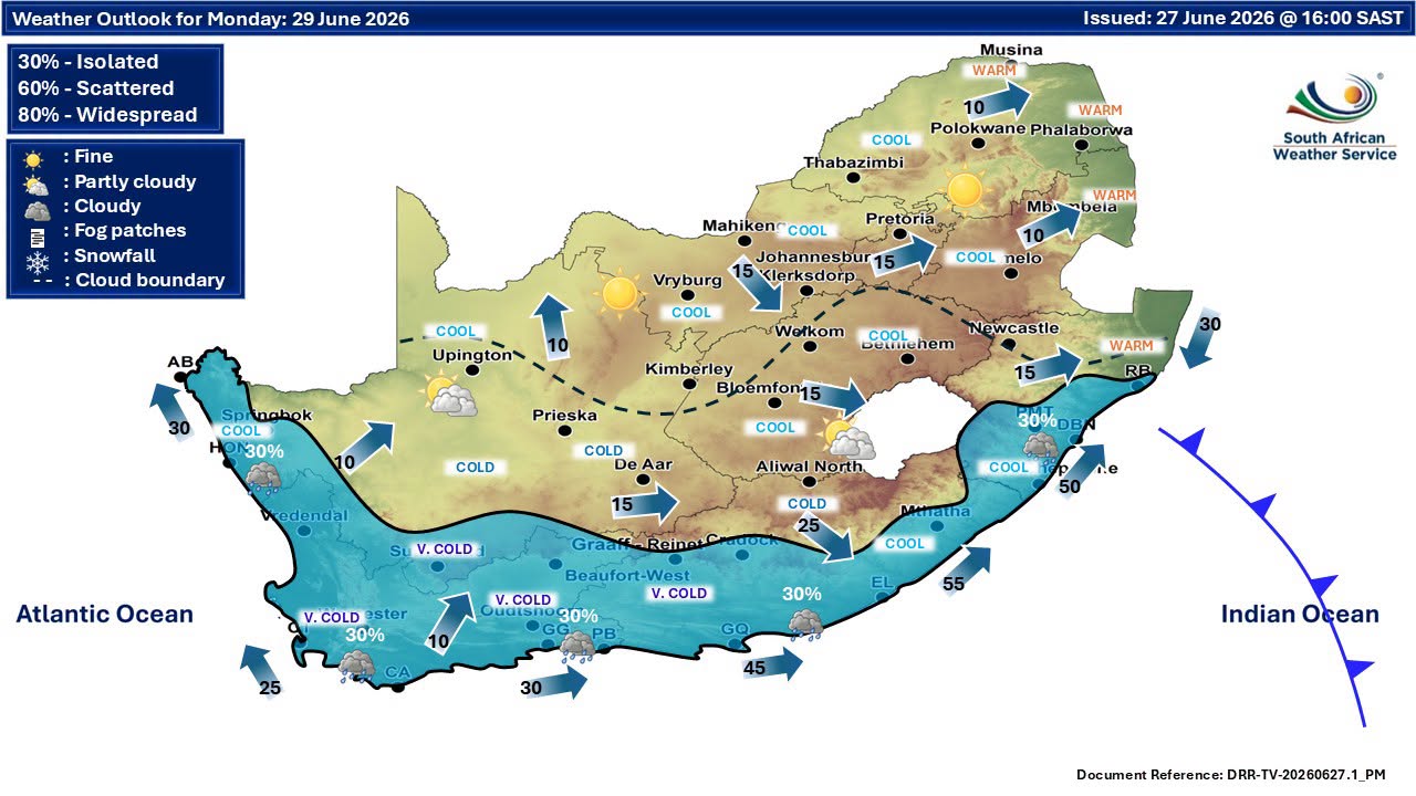
Garden Route temperatures are expected to turn colder by Monday, while the Karoo faces a sharp winter chill.
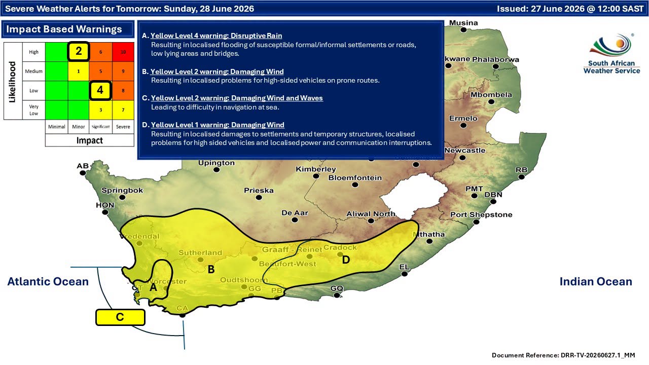
Cold front to hit Western Cape coastline
The South African Weather Service (SAWS) has issued a Yellow Level 2 warning for wind and wave conditions affecting the Western Cape from Sunday morning through to Monday evening.
According to the warning, a cold front is expected to make landfall over the western parts of the province on Sunday, bringing very rough sea conditions between Cape Columbine and Cape Agulhas before spreading eastwards towards Plettenberg Bay later in the day.
South-westerly swells of between 4m and 5m are expected, accompanied by westerly to south-westerly winds of 50km/h to 65km/h, with gusts reaching between 70km/h and 90km/h.
Long-period swells of between 15 and 17 seconds are also forecast.
Conditions are expected to begin moderating from Sunday evening, although wave activity may persist into Monday evening.
Small vessels and beach activities could be affected
The weather service warned that the expected conditions could create difficult and potentially dangerous conditions along affected coastal areas.
Impacts may include:
- Difficulty in navigation for small vessels and personal watercraft.
- Increased risk of vessels taking on water or capsising.
- Localised disruption to beachfront activities.
- The possibility of members of the public being swept off low-lying coastal rocks because of strong and prolonged wave action.
Authorities are urging residents and visitors to avoid unnecessary exposure to hazardous coastal areas while the warning remains in place.
Garden Route temperatures for Sunday and Monday
While Sunday is expected to remain relatively mild in the Garden Route before conditions deteriorate later, a noticeable drop in temperatures is expected on Monday as the weather system moves through the region. Forecast temperatures indicate:
Sunday: High of around 21°C, low of 13°C
Monday: High of around 13°C, low of 10°C
Residents can expect increasing cloud cover, cooler conditions and the possibility of rain as the cold front pushes eastward.
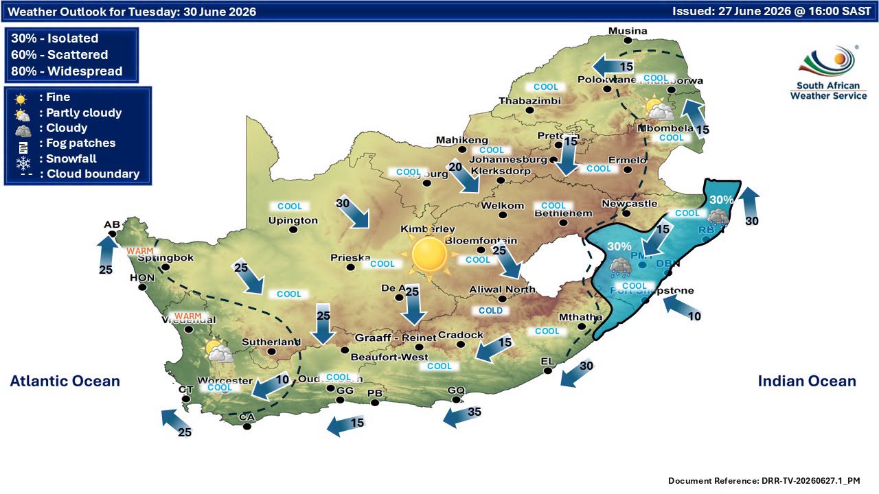
Karoo in for a colder spell
The Karoo is also expected to feel the effects of the winter system, with colder daytime temperatures setting in behind the front.
Sunday: Approximately 16°C maximum, low near 6°C
Monday: Approximately 11°C maximum, low near 3°C
Cold morning conditions are expected, particularly across inland areas where temperatures could feel significantly lower due to wind chill.
Public urged to remain cautious
Winter weather systems regularly bring rough seas to the Western Cape coastline, but the combination of strong winds, large swells and prolonged wave periods could make this event particularly hazardous.
Beachgoers, anglers and anyone planning marine activities are being urged to monitor updated forecasts and heed official safety advice as conditions unfold.
‘We bring you the latest Garden Route, Hessequa, Karoo news’


