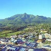
GEORGE NEWS - Some of the ground works for the Village Ridge development in Highlands was stopped by the Department of Environmental Affairs and Development Planning after a complaint was received that a wetland on the property had allegedly been destroyed.
A section of the nearby Camphersdrift river bank had also allegedly been damaged by a bulldozer.
According to Rudolph van Jaarsveldt, media liaison officer for Environmental Affairs, the wetland area had been filled in by the time the work was stopped. "A Compliance Notice and Directive was issued on 27 May and we await the alleged offender's response," he said.
The developer, Power Group, recently moved onto the property to start construction after in application process of more than three years. Stefan Bothma, CEO of Power Developments, confirmed the notice from the department. He said the company was ordered to create two no-go areas, one around the wetland and another near the river.
"We have launched a Section 24G application* that involves specialists and could take 60 to 90 days. In the meantime we are continuing with construction."
George Municipality disputes the existence of a natural wetland. Communications chief Chantel Edwards-Klose said at the time of the approval of the development, Environmental Affairs confirmed that the proposed development did not trigger any listed activity in terms of Nema (National Environmental Management Act) and the report from the heritage practitioner confirmed that there are no features of historic significance.
"The latter report illustrates that a dam existed in 1936, but in a different position from the 'wetland' seen on more recent photography. The 'wetland' does not appear to have existed before the 1980s, and the water feature only appears around 2003, with visible changes to vegetation typology in 2012.
"The planner's report did not include any breach of the existing watercourse and biodiversity area that commonly form part of the Rooirivier catchment," said Edwards-Klose.
Speaking anonymously, an unhappy resident said the Highlands wetland is right in the middle and part of the registered Camphersdrift wetland area. During the public participation process of the development application, the King George Ratepayers Association objected to the density of the development and requested the wetland to be preserved. Some evidence of the existence of a wetland was handed in, including an aerial photo from 1975 showing the natural water courses.
 The site in Highlands where the Village Ridge development is being built. Extensive ground works have been done and an alleged wetland has been filled up.
Photo: Alida de Beer
According to the comment submitted, there is no surface runoff water that flows into the "so-called dam", and there are no natural waterways that can feed it. There is also no sign of a dam wall on the aerial photo.
Juan Barnard, Freedom Front Plus candidate for the ward and vice-chairman of the Garden Route Dam Action Group (Gardag), said the Highlands wetland has been identified as a "headwater" wetland with typical plant communities, soil profile and water regime during the wet season.
Edwards-Klose said due regard was given to respondents' concerns in the public participation process and specialist reports were requested to address the concerns. "The municipality has no reason to doubt the integrity of these specialist reports and the recommendations were applied accordingly."
An S24G application is launched after the unauthorised start of activities identified in terms of the Environment Impact Assessment regulations. The Environmental Affairs minister or relevant MEC must consider information submitted and either grant an environmental authorisation or direct the applicant to cease the activity and rehabilitate the site.
 A photo supplied by the King George Ratepayers Associaton which they say demonstrates the wetland's water regime during the wet season.
'We bring you the latest George, Garden Route news'


